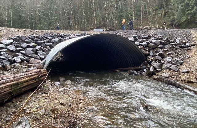
LEI Engineering & Surveying of Oregon completed the route surveying, hydraulic surveying, hydraulic analysis and design, structural analysis, and roadway design for a 39-foot structural plate arch over the Nestucca River, on the Nestucca River Back Country Byway, west of Yamhill Oregon.
The existing structure at this crossing was a 10-foot span box culvert that provided minimal to no fish passage. Due to site constraints, a bridge was not possible at this location. LEI Engineering & Surveying of Oregon worked with the BLM Hydraulics Resource Specialist to determine the channel width that needed to be spanned by a structural plate arch drainage structure. During this discussion and analysis, it was determined that not only should the structure span the 35’+ active channel width, but a 9-foot width low water channel should be included along the river thalweg to provide adequate depth for fish passage during low flow conditions. It was also determined that the channel design through the structure should provide boulders and large woody debris to simulate the natural river channel.
The developed design incorporated these hydraulic and stream geomorphology components to provide both an economically feasible and environmentally friendly crossing.

